A Universal View From Nowhere: Tracing the Boundaries of Digital Space
by Heba Y. Amin
Territorial maps were meant to be an extension of the territorial state, serving as a visual claim to jurisdiction and sovereignty; they “enabled governance to become geographic in the first place.’’[1] Digital mapping, on the other hand, regards territorial claims and national borders through the marketing of spatial knowledge by strategically exhibiting dynamic representations of power. It has not only altered the way we perceive and define space, but has profoundly impacted the ways in which citizenry and mobility are dictated through the virtualization of borders, the surveillance of landscapes, and the cyber-technological control of movement. The old models of sovereignty based on concrete control of territory are now being replaced by mobile or itinerant sovereignty, fundamentally transforming the global political narrative in a geographic way.[2]
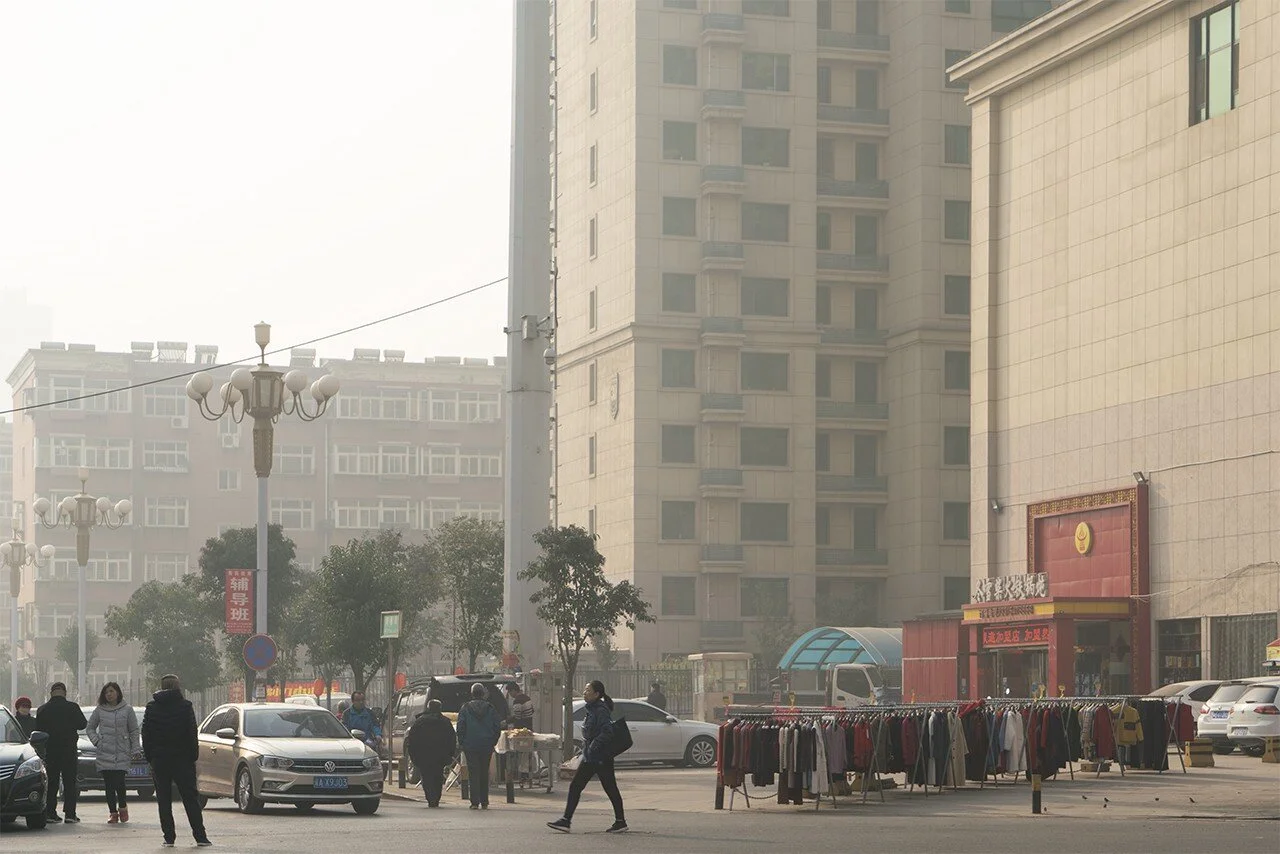
110.241.60.153, China Unicom(ISP), 37.99460801866319,114.48833577473958(GCJ02), Tatan District, Shijiazhuang, Hebei province — images by Cheng Guo
What happens to the integrity of national borders when political and technological sovereignty are put into question through grossly imbalanced power structures? Surveillance over entire populations has gone beyond anthropometric policing and into biometric data control. This means that the structuring of space is pursued in accordance to the archiving of the global movement of bodies. As navigation systems becoming increasingly sophisticated, so are secret systems of monitoring and tracking. A flight simulation on Google Earth takes one on a cinematic journey through massive data sets of open-access satellite imagery collected from many of the same companies that provide intelligence to U.S. government agencies.[3] With the advent of GPS, the U.S. military is at the center of a new spatial infrastructure that stemmed from American global power and, in turn, broadened their scope of spatial control.[4]
Google Earth proposes a new political cartography where satellite imagery definition is dependent on national territories: “third world low-res” refers to the resolution of pixels in relation to political national constructs that mimic power dynamics of global economics.[5] Corporate giants like Google are bound up in our territorial mobility and have also been an instigating source of conflict — depending on whose needs are being met — particularly in territories with disputed borders or remnants of colonial claims to land. Digital maps are not exactly objective. Making a “truthful” map that represents “a universal view from nowhere” is not the central focus or aim of digital mapping, but rather, how to accommodate corporate and military demands for aiming, measuring, and navigating.[6]
Countries like China bypass these global corporate models in favor of their own systems of control. The Great Firewall of China (GFW) blocks its citizens from accessing foreign websites such as Google, Facebook, and Twitter as well as slowing down cross-border internet traffic to control the country’s internal internet economy. It also serves as China’s internet censorship infrastructure and extends beyond the borders of its sovereign territory through Chinese cell service providers. Therefore, no matter where Chinese citizens are located geographically, their data usage will be compromised by the same censorship barriers faced in China.
In 2018, Chinese artist Cheng Guo spent several months tracking geo-locations of the Great Firewall. His extensive research project, The Net Wanderer, saw him tracing the boundaries of the firewall’s critical nodes. By pinpointing the coordinates of their IP addresses and visiting their geographic locations, he sought to map the infrastructure of Chinese censorship. When tracing coordinates of IP addresses, Guo uses an API provided by Baidu to convert the world geodetic system (WGS84) to the GCJ02 system, an encrypted coordinate system used in China and sometimes referred to as the “Mars coordinate system”. The Surveying and Mapping Law of the People’s Republic of China, adopted in 1992, outlines its provisions regarding geospatial information and the landscapes it represents.[7] According to Chinese law, it is illegal to draw maps without the permission of the Chinese government — few Chinese companies have received a green light to do so. Therefore, international mapping services like Google Maps do not have access to an accurate map of China since the two different coordinate systems produce an algorithmic offset.
Wandering on the digital map ultimately means a displacement of coordinates, unveiling in-between territories where virtual borders do not match the physical ones. “The missing territories in the digital world can be seen as a conflict between two coordinate systems,” says Guo. In this sense, visualizing the discrepancy between two mapping systems also reveals the conflict between differing ideologies and renders their flexing of power visible. Guo’s performative exploration nods to practices in psychogeography that aim to reconfigure the socio-political constructs of space; the project manifests as a provocative social choreography, particularly when the act of mapping can be regarded as a criminal gesture.
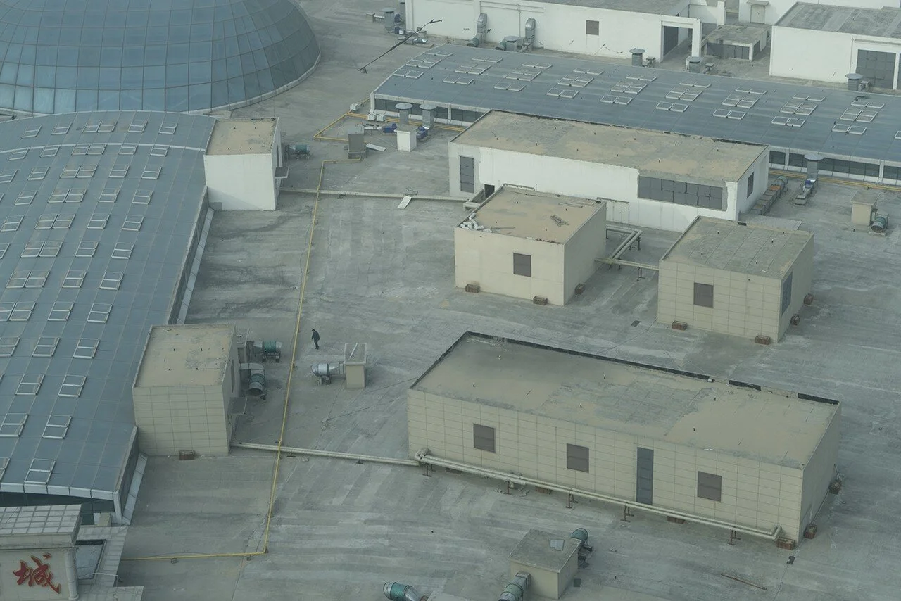
112.66.3.121, China Telecom(ISP), 109.51588243272569, 18.258758680555555(GCJ02), Sanya, Hainan province — image by Cheng Guo
Through photo and video documentation, Guo presents select data points for “border tourists” to contextualize and contemplate along his physical tour of the Great Firewall. Furthermore, the artist’s installation and first iteration of his research, A Tour of Suspended Handshakes, allows viewers to encounter the wall in the digital world via Google Chrome’s hidden game — Chrome Dino or the NO INTERNET GAME — which can be played offline when your computer or device fails to connect to the Internet. As you explore the limits of the Chinese Internet where ‘handshakes’ are blocked from establishing the protocols of communication, Chrome Dino triggers the tracking of your IP address and etches it onto a wall like graffiti, leaving a permanent tag of your online identity. Both the stand-in wall and the firewall tour question the discourse of border fortification which has become an all-too-common solution to the problem of the securitization of nation-states.
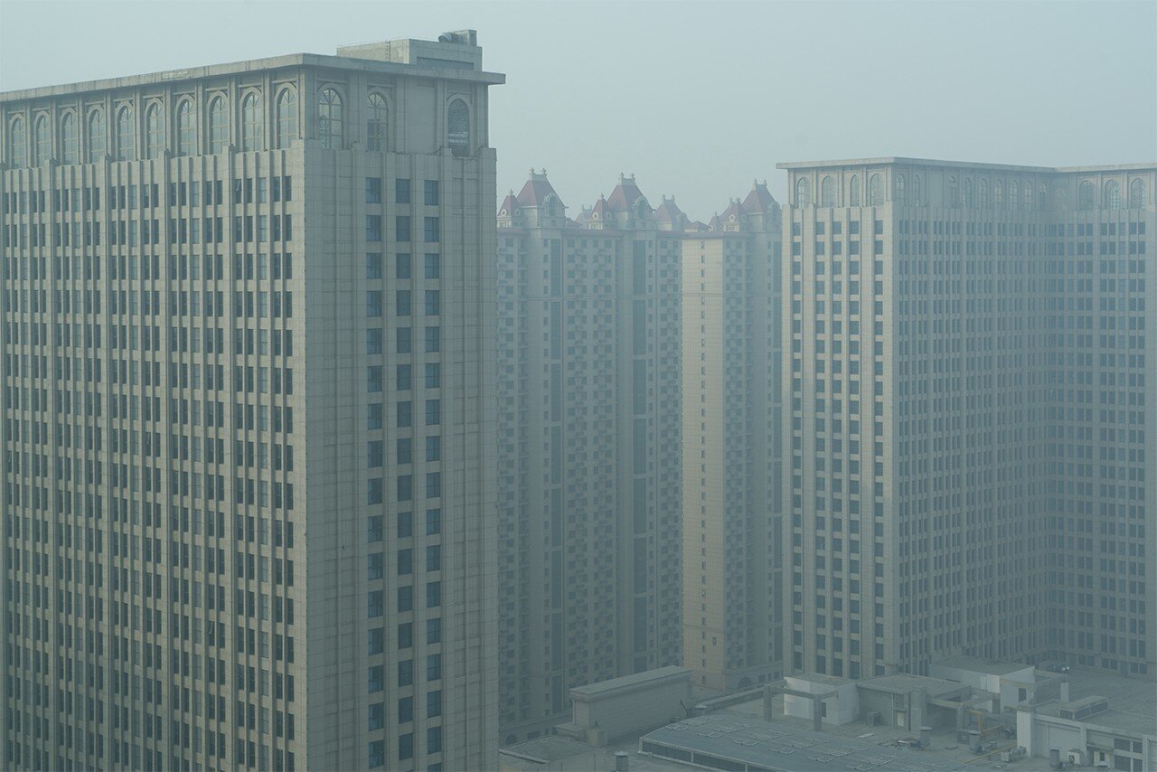
The artist’s photographic journey reveals otherwise mundane landscapes — high-rises, street scenes, urban infrastructure — that serve as a representation of power and ideology. The visuals of the locations are not particularly indicative of what one might imagine to be the omnipresent systems of oppression. Rather, the images relay a discomforting reality where regular citizens live seemingly unaware among the infrastructures that control their every-day interactions. The artist’s laborious process of attempting to make the Great Firewall visible serves as a reminder to the ways in which our autonomy is often compromised through corporate and government control framed as a solution to societal problems. Guo’s documented wanderings portray a body seeking and searching for “a universal view from nowhere” or, at the very least, ways to challenge the limitations of spatial knowledge and confront the borders of digital space.
References:
[1] Rankin, WIlliam. After the Map: Cartography, Navigation, and the Transformation of Territory in the Twentieth Century. Chicago: (University of Chicago Press, 2016), 6.
[2] Achille Mbembe,“Violence- Dictionary of Now” November 5, 2015, HKW, Berlin. Keynote Speech.
[3] Dorrian, Mark, and Frédéric Pousin, eds. Seeing from Above: The Aerial View in Visual Culture. London: (I.B.Tauris, 2013), 302.
[4] Rankin 6.
[5] Dorrian 302.
[6] Rankin 67.
[7] “Surveying and Mapping Law of the People’s Republic of China.” Invest in China, www.fdi.gov.cn/1800000121_39_2073_0_7.html.